Levenshulme Neighbourhood Plan
Neighborhood Plan
Levenshulme Neighbourhood Plan proposal developed by a group of seven students from previous planning analyses of Levenshulme arae. It concludes with a preferred option, recommendations and a spatial vision, which are appropriate for improving Levenshulme and should be used to steer the Neighbourhood Plan. Importantly, details of community engagement strategies, findings from analyses of Levenshulme and a basic conditions statement have been included in this document to evidence the development of the options and final spatial vision, and to ensure the plan meets relevant legislation.
Levenshulme Neighbourhood Plan: Baseline brief of public space improvement
Baseline Report
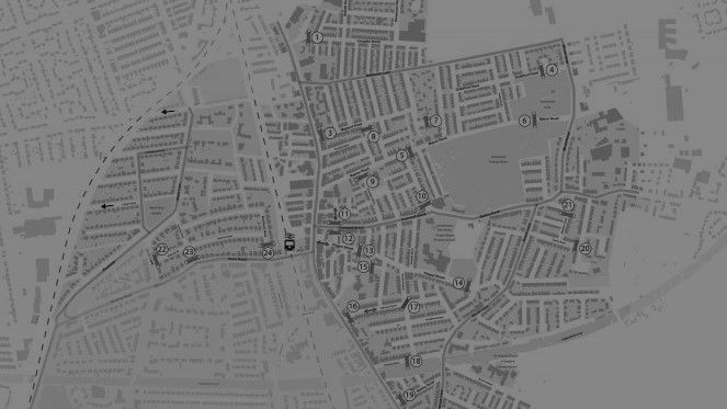
Levenshulme neighbourhood is located in south east of Manchester city, it considered as a linkable zone that connects Stockport district with Manchester city centre, as the light rail way and Stockport road are the main corridors for levenshulme and Stockport residents to access Manchester city centre. This situation leads to a high amount and different types of transitory such as drivers, pedestrian and public transportation users among levenshulme neighbourhood. The neighbourhood is mainly divided into two mains areas, the west side area, which is more developed as the majority of Westside residents have higher quality homes with front and back gardens, while the east side area is more deprived in term of housing quality. However, both areas are having equal access to public space and facilities.
The latest statistics shows that the total population of Levenshulme neighbourhood is about 13051, 65% of them are white British, 13.5% are Asian British, about 7% are white Irish, while the rest of population are from other ethnic groups such as black, Chinese and other mix ethnic groups. This statistics demonstrates that Levenshulme population represents a diversity of different backgrounds; it’s easy to catch Christian prayers in Sundays and Muslim prayers in Fridays. As well, many mosques are located behind churches, while other leisure centres such as pubs, sport centres and community centres are full of diverse people from all over the neighbourhood. This is a very pleasant life way, where any one can enjoy his life style with others.
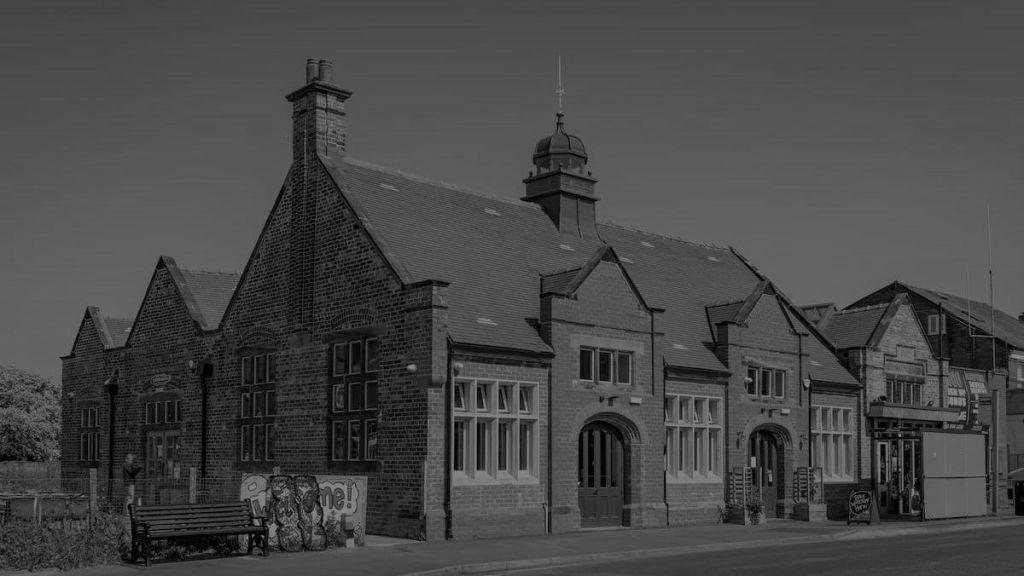
In fact, Levenshulme is full of different types of public space areas, as there are worship buildings, pubs, community centres, local markets, permanent local shops, library, sport centre, green spaces, well paved main road, and bike lane. Alongside with a diverse type of public spaces, there are many attractive annual event takes place in Levenshulme, such as The Market Festival, Food and Drink Festival and Beer Festival. Those events take place in many areas around levenshulme and in many different seasons during the year. These festivals create a great opportunities to locals to present what they has, and for visitors to enjoy their time.
There are many reasons behind the importance of improving public spaces, it’s not just because the rich and divers public space assets located in Levenshulme. Actually the well planned public spaces can have positive economic, health, social and environmental impacts. First, the well-designed public spaces enhance the economic life in urban centres as it attract many investors, business and local markets to set in within the proper public spaces fabric of the urban centres, as well it encourage the visitors to wander within the area which in return increase the market power. Second, the well planned public spaces can be a main reason behind reducing both, the amount of obese children and old peoples who suffer from diabetes and heart diseases, plus, it develops the social, emotional and physical skills of new born and children. Third, the well accessible public spaces create an equal free access to everyone regardless the ethnic, gender and class backgrounds, in return it deepen the democratic approach of the right to equal citizenship. Finally, the more green space the more air quality is there, and the big green space can be allocated to wildlife habitats within the city fabric, this would in fact increase the environmental value of the city compared with rural areas.
Residential Development Proposal
Appraisal Report
The report is about to deliver an appraisal for a development proposal at site in Oldham borough at Greeter Manchester. The report covers legislation, policy, planning, socio-economic and market aspects necessary to come up with the best decision to develop the site, these aspects are highly important for clients who intend to develop the specified site, as it gives them an inclusive overview about the development environment in the site.
On one hand, Oldham borough can be considered as a residence area in northeast of Manchester. However, Oldham is a main hub of labors and workers as well, as the population is about to jump from 224,999 to 241,1600 by 2020, and the average of population age within 30 min drive from Oldham town center is younger than average of population age in UK as a whole. In fact, Oldham Council states that “The borough’s working age population is over 157,000 with 34.2% profiled in the 25 – 44 year old age group (both of percentages are higher than the national average” (Oldham Council, 2017). This percentage demonstrates that Oldham represents a hub for younger workers. On the other hand, Oldham is a home for 6000 business; taking the fact the three are 101,555 registered brands within 30 min drive from Oldham town center. These business types are vary, as there are many manufacturing, health, construction, creative, financial and professional services sectors taking place in Oldham. The district represents a high socio-economic hub as there are many other national and international brands locate within Oldham Borough.
In that case, the report examines the site characteristics and planning policy related the development option. As well, the report delivers a full development appraisal and evaluation for the preferred option in order to come up with best recommendations and conclusions.
